Implementation of a participatory and co-constructed approach to territorial resilience to natural hazards in the Valentin valley, commune of Eaux-Bonnes, to better integrate the challenges of adaptation to the consequences of climate change.
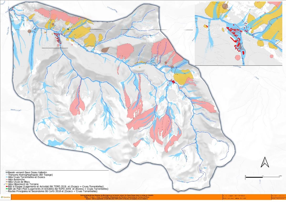
The valley of Valentin on the commune of Eaux-Bonnes (64) presents many stakes concentrated on a restricted linear:
- The biggest ski resort of the Pyrénées - Atlantiques (Gourette)
- Three or four campings close to the river or at risk of flooding,
- The Rd 918 access to the resort in winter and to the Aubisque pass in summer
- The hydroelectric production.
- Thermal baths at Les Eaux Bonnes
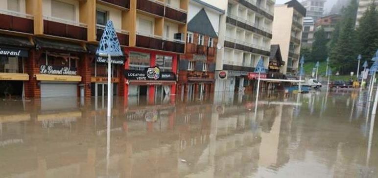
This valley is subject to many risks and environmental constraints that leave limited opportunities for sustainable development.
 |
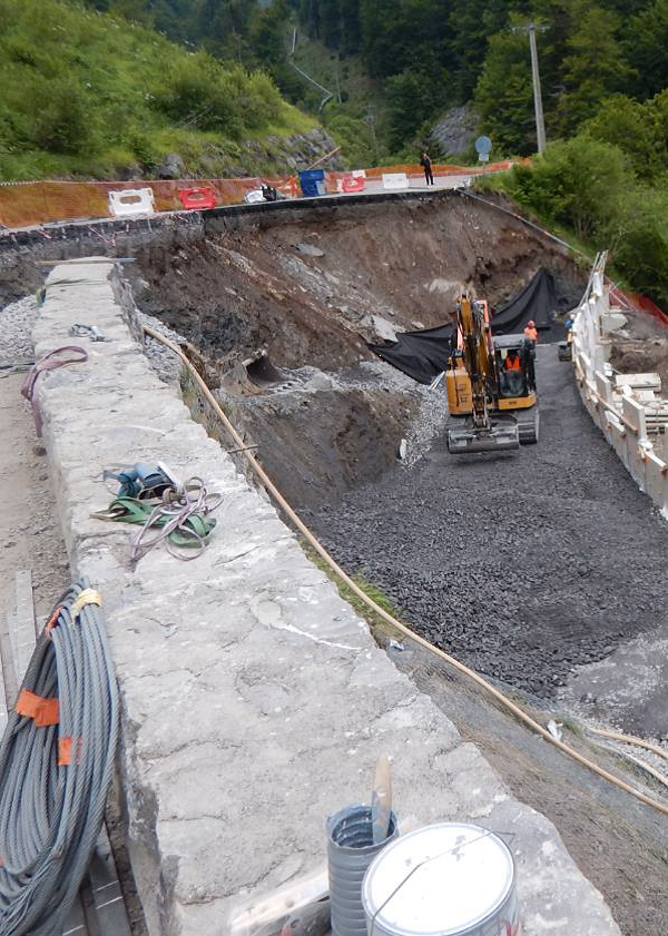 |
The knowledge of these risks in the current context is globally well identified and has been the subject of additional inventories by ONF-RTM in the framework of Montclima: 680 events recorded since 1800, including 604 avalanches, 11 block falls, 33 landslides / mudflows and 32 torrential events.
In addition to the updated inventory of these 4 hazards, Cerema has calculated the potential envelope of the runoff hazard on the basis of a 5 m DTM of the IGN with the Exzeco method.
An analysis of the stakes impacted (BD TOPO 2019) in the study area by these envelopes of torrential floods (ONF-RTM) and potential envelope of runoff hazard (Cerema - Exzeco) shows the stakes impacted or contained in these envelopes:
37 single-storey buildings out of 157 (23.5%), 104 multi-storey buildings (housing and activities) out of 332 (31.3%), 43 engineering structures out of 80 (53.7%), 5,303 kms of main and secondary roads out of 80,330 kms (6.6%) and finally 69 jobs and activities (BD Sirene 2021) out of 261 (26.4%)
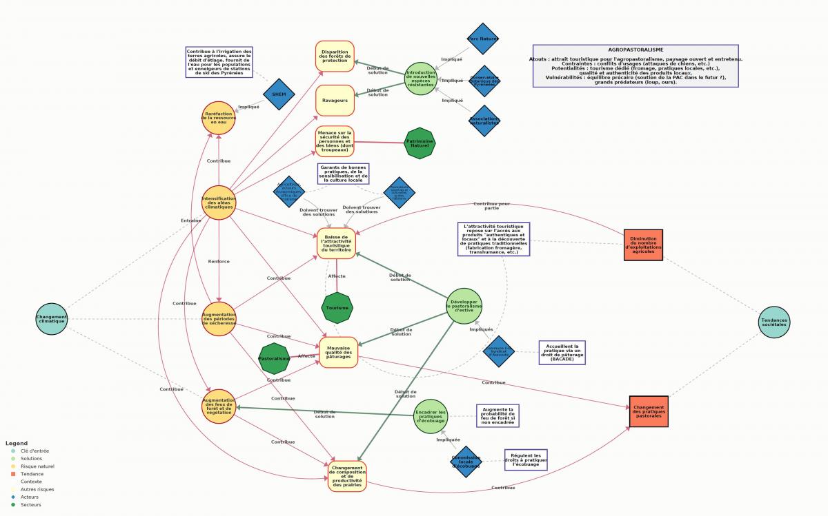
The challenge and interest of the risk resilience approach undertaken in this territory is :
- While updating locally the past knowledge on hazards, to integrate as well as possible the uncertainties and trends calculated on the scale of the Pyrenean massif (scientists) on the effects of climate change in terms of intensity or frequency by considering these trends as acquired within the framework of this territorial approach, which postpones in part the reflections / debates and energies on "how to adapt and become more resilient".
- To avoid exclusively technical and/or expert approaches and to engage in a reflection with the actors of the territory through a co-constructed diagnosis, fed by their field visions and reflections or knowledge of other territories.
- To engage a systemic approach, which establishes links between issues and actors, loops, networks and chains of impacts at several levels.
- To question the long term (30 - 50 years) and to move towards an operational action plan that will guide the adaptation of the territory towards more resilience.
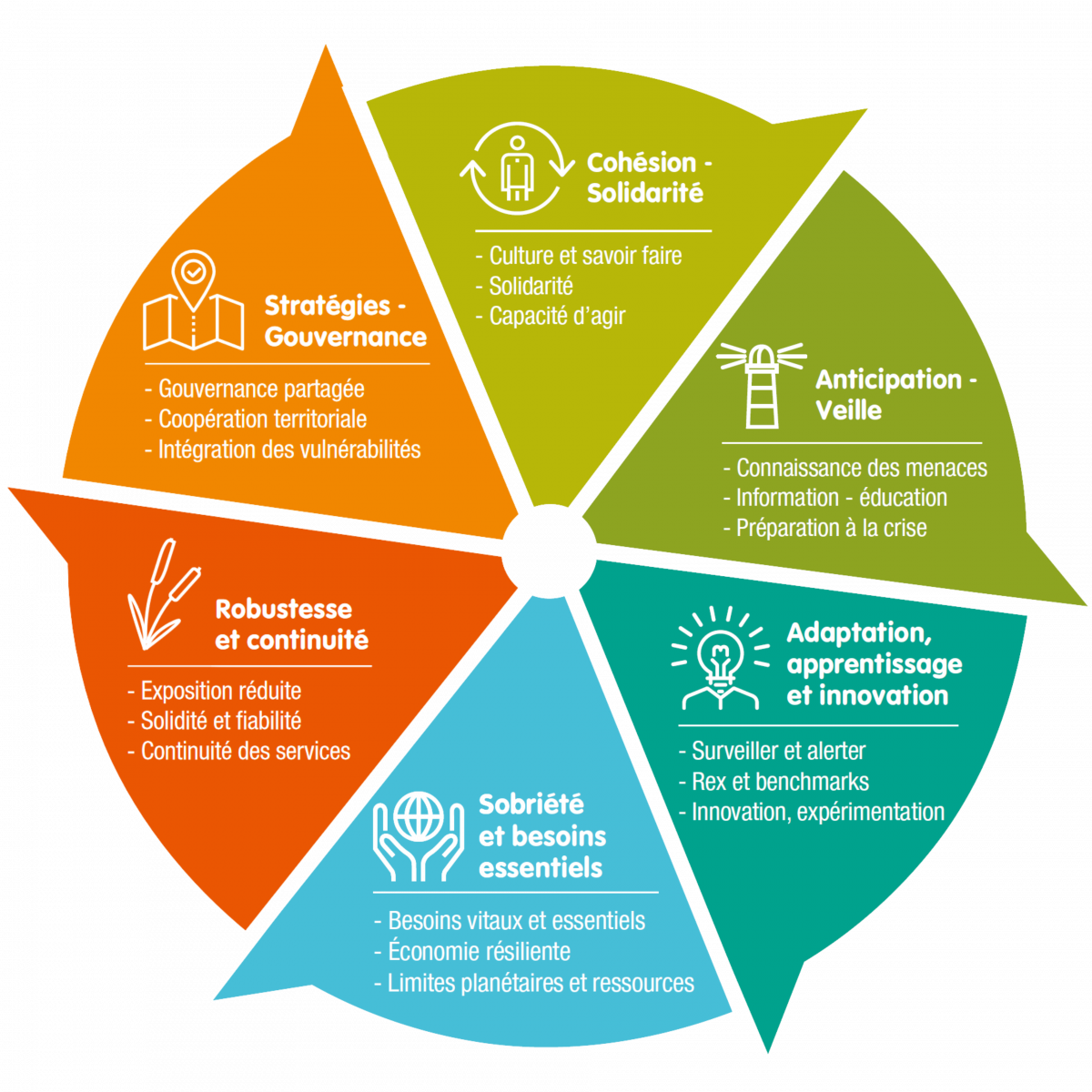 Resilience Compass - Framework for Thinking